Maps of Morocco
Physical Environment
- World Location
- Topography
- Elevation
Weather and Climate
- Climate Types
- Seasons
- Solar Radiation
Human Environment
- Population Density
- Economic Activity
- Ethnolinguistics
Road Maps
- Highways
- Multi-transportation Routes
- Roads and Trails
City Maps
- Major Cities
- Provinces
- Province Capital Cities
Urban Transportaion Maps
- Northern Train/Bus Route
- Southern Train Route
- Airports
Tourist Maps
- Region Descriptions
- Tourist Route
- Caution Areas
Physical Environment
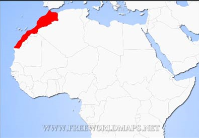
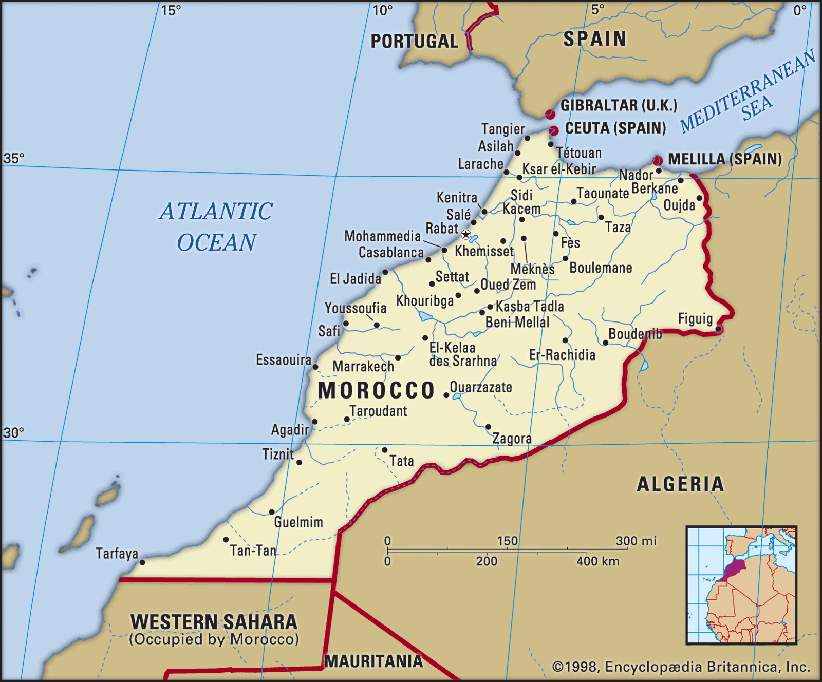
This map shows where Morocco is located in Africa.
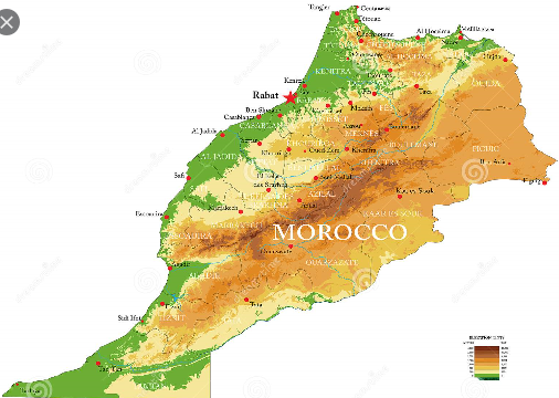
The map above shows the topography of Morocco.
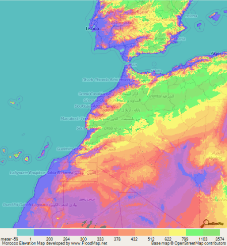
The map shows the varying elevations in Morocco.
Weather and Climate
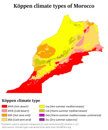
Displayed above is a map showing the different climates that can be found in Morocco.
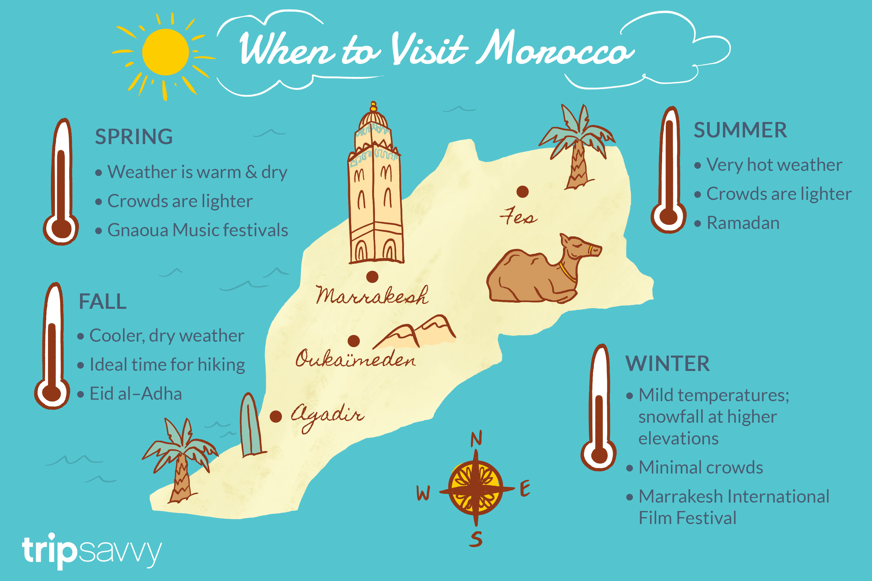
Explained in this map is what each season will be like, on average, in Morocco.
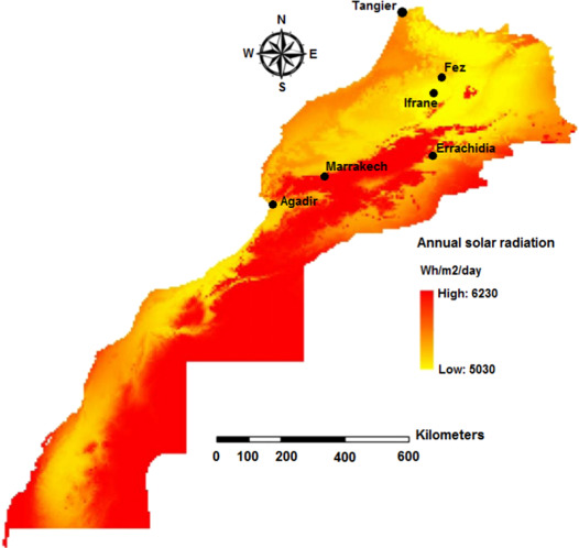
Showed in the display above how much solar radiation areas get in Morocco.
Human Envirinment
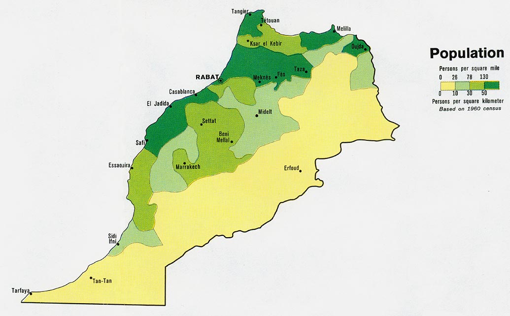
In the map above it depicts the population density in Morocco.
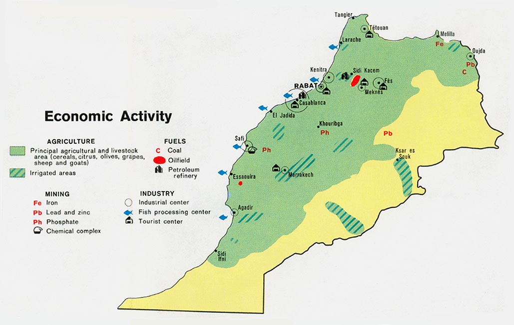
Depicted above is a map that shows the economic activity that goes on throughout Morocco.
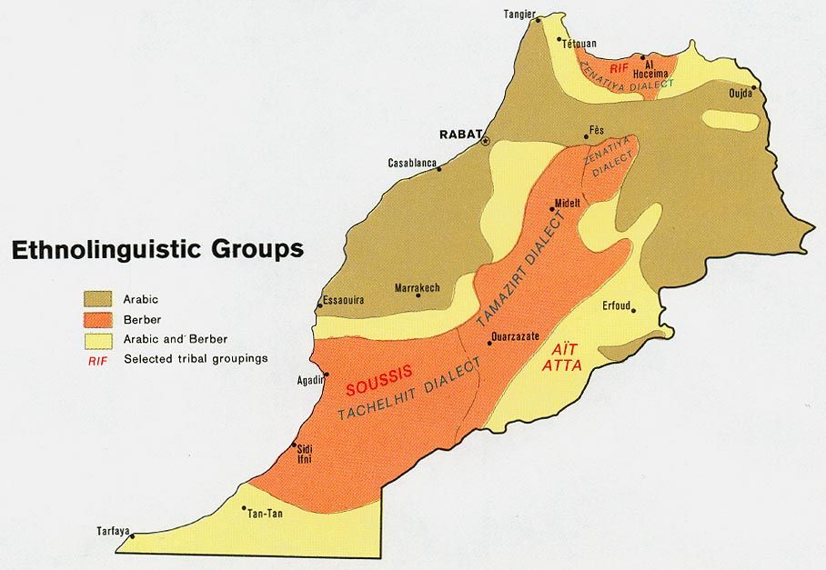
This map depicts the different ethnolinguistics of Morocco.
Road Maps
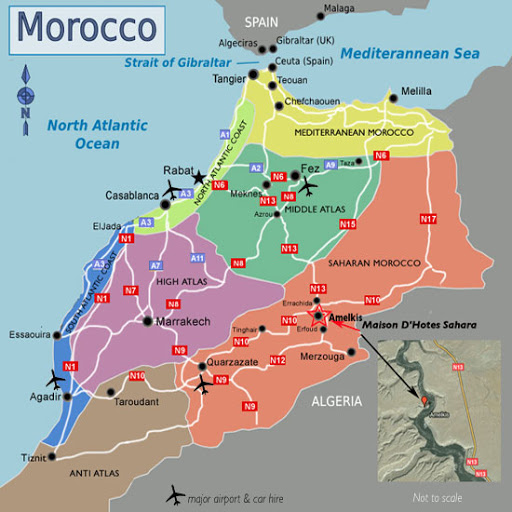
Above is the many highway systems in Morocco.
This map shows a variety of transportation routes that are in Morocco.
The multitude of trailtracks that are in Morocco is desplayed above.
City Maps
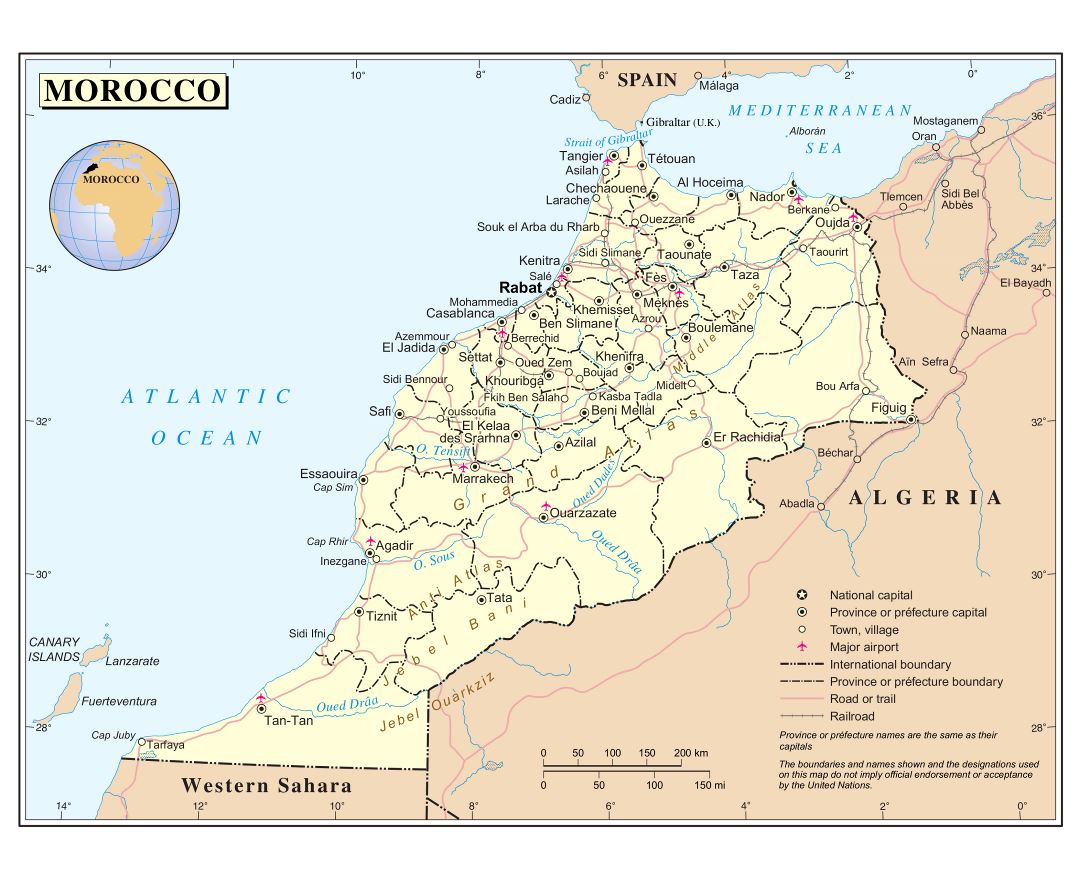
Displayed is a map that shows where the major cities are located in Morocco.
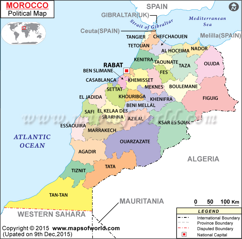
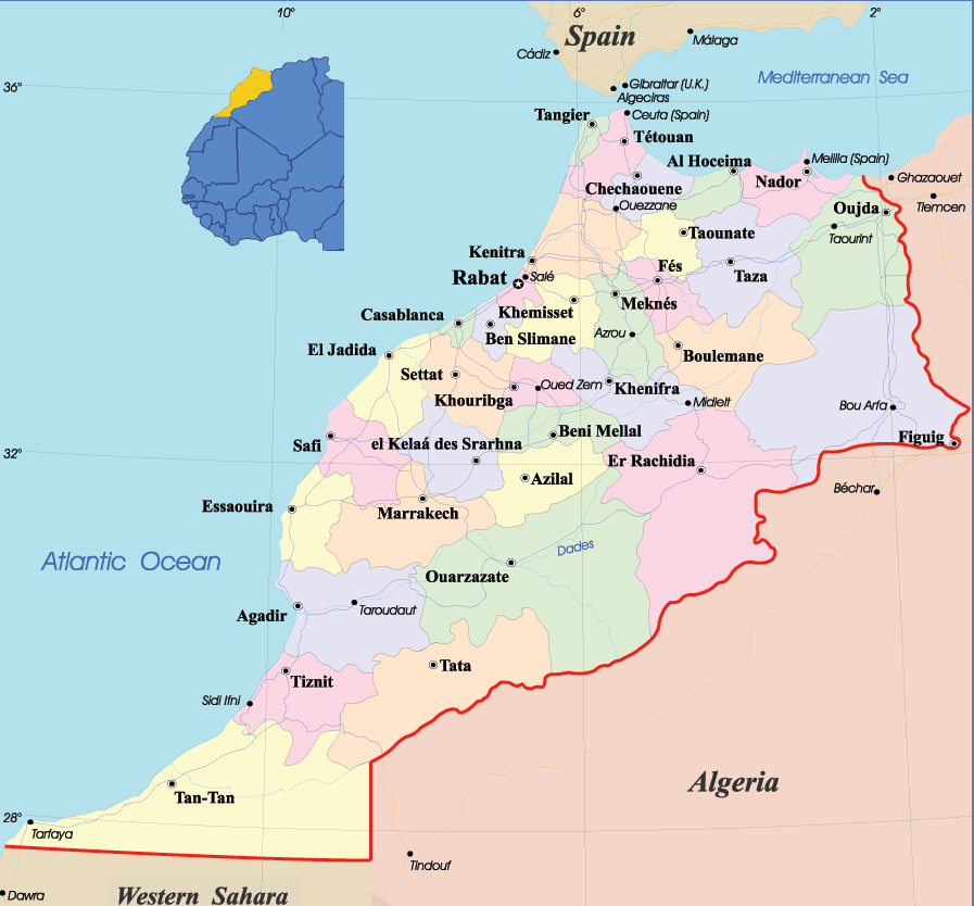
Presented above is a map showing the different provinces located in Morocco.
This map shows where the capital city of each province is in Morocco.
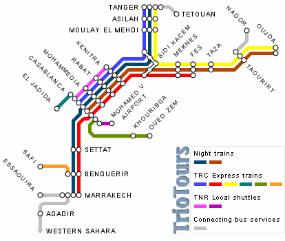
Urban Transportation Maps
Shown above is a simplified bus and train route in Morocco.
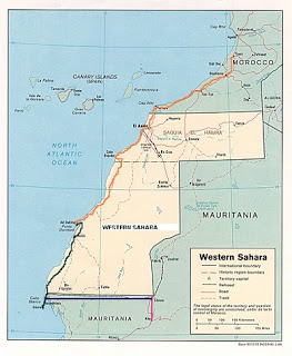
These are the main train tracks that run through Southern Morocco.
These points are where all of the major airports are located in Morocco.
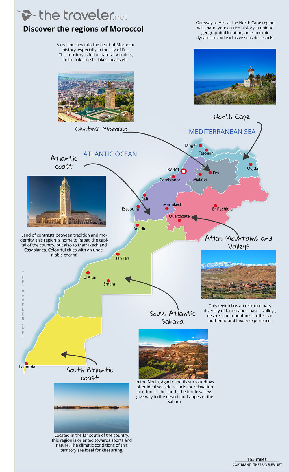
Tourist Maps
Here are short descriptions of each region in Morocco.
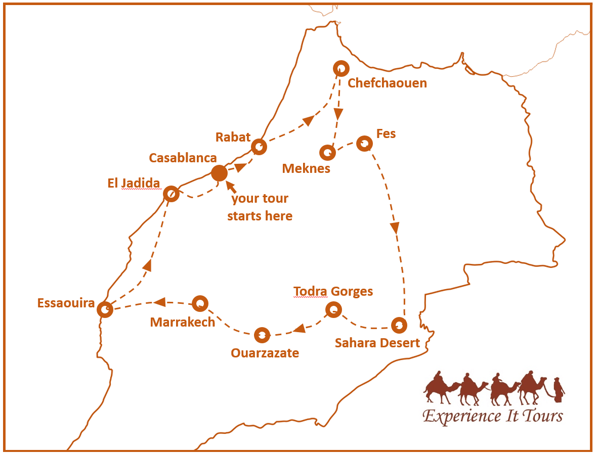
On the map it gives the best tourist route to experience Morocco.
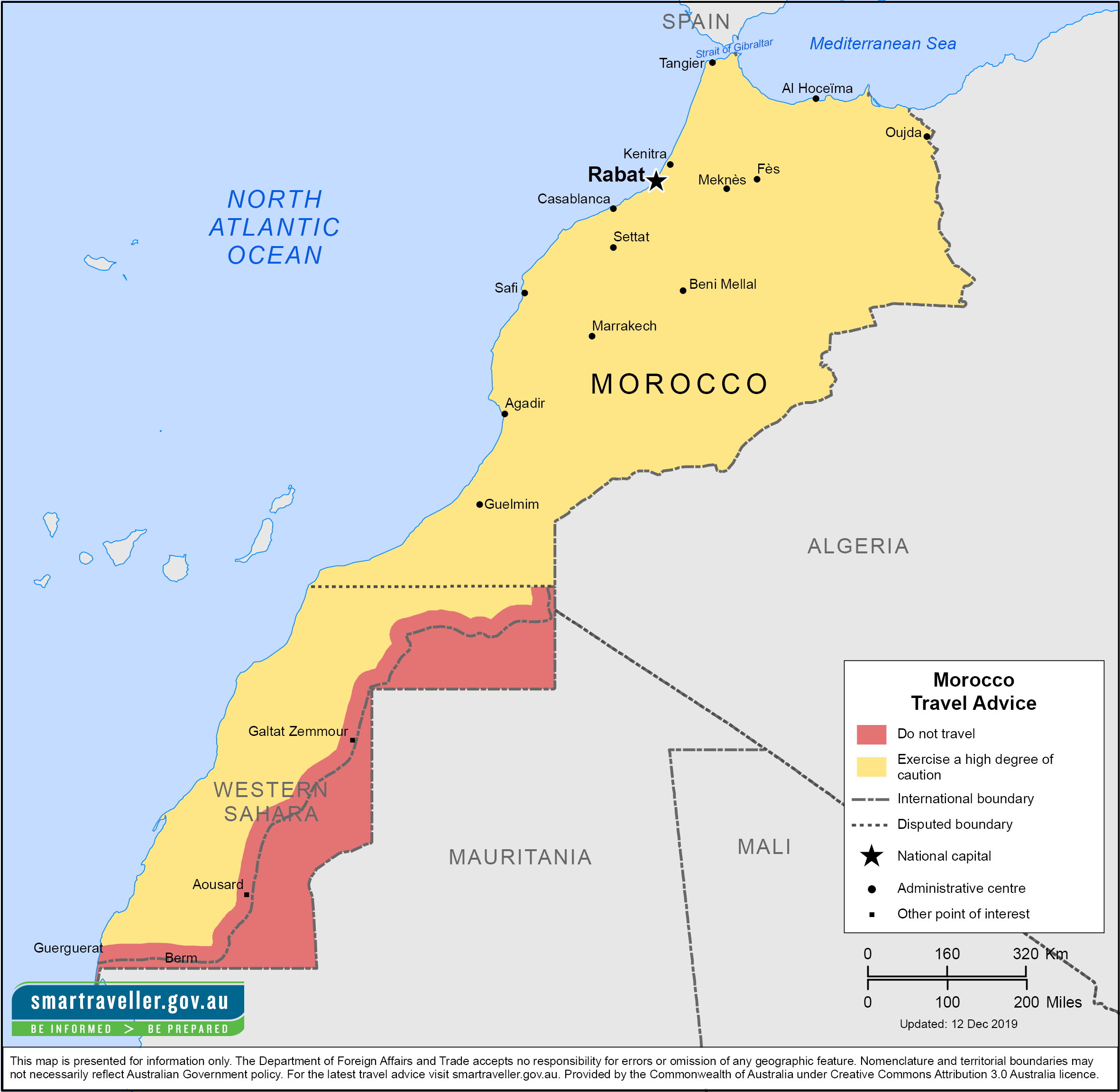
Given above are the degrees of caution when traveling in different areas of Morocco.